Hiking
Things To Do
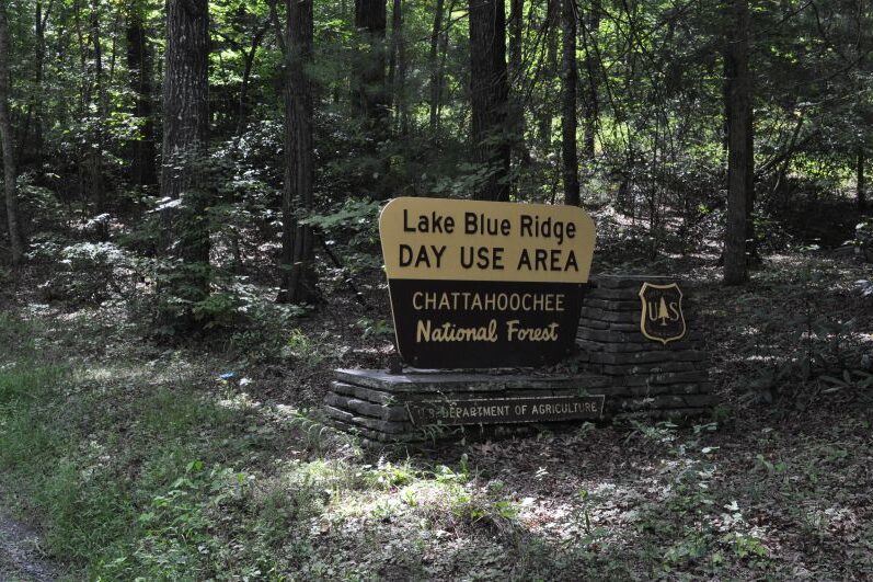
Lake Blue Ridge Trail
TYPE: Easy
LENGTH: 0.6 mile Loop
The Lake Blue Ridge Trail is located in the Toccoa Ranger District. It is a 0.6 mile loop trail that follows the shoreline of Blue Ridge Lake and offers a beautiful view of the lake. The trail is flat and considered a good trail for families with young children. The trail begins and ends in the picnic area.
Ocoee Whitewater Center Trails
Phone: 423-496-0100
TYPE: Easy to Difficult
LENGTH: VariesThe Ocoee Whitewater Center is home to the Tanasi Trail system. Boasting more than 20 miles of trails, this trail system has it all. From a hike with history along the 2.4 mile restored segment of the Old Copper Road Trail, or an easy 1 mile stroll around the Olympic course at the Whitewater Center to a screaming 1.5 mile mountain bike ride on the Thunder Rock Express, mountain bikers and hikers alike will be challenged and rewarded when they reach the top of Bear Paw Loop and travel Chestnut Mountain Trail to sites that overlook the Whitewater Center and the Ocoee River. After a long hike, cool down by swimming in the well-known “blue” hole at the whitewater center!
HELPFUL TIPS FROM LOCALS: This site requires a $3 parking fee. There are several great swimming spots along the way. Make sure the water is not generating for rafting before you enter the water. If the water is generating, entering the water is highly dangerous.
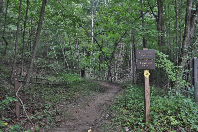
Long Branch Loop Trail
TYPE: Easy
LENGTH: 2 mile Loop
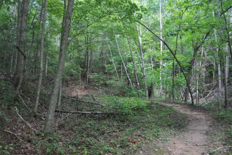
Long Branch Loop Trail is part of a hiking-mountain bicycling trail system that is 17 miles in length on National Forest land. Trails range in length from 1.0 to 5.5 miles and are open to the recreational public year around. This trail begins at the northeast corner of the parking lot and is marked with bright green blazes. The Long Branch Loop is approximately 2.0 miles long and is rated easy. It is designed for day hikers and mountain bikes, no horses or motorized vehicles are allowed.
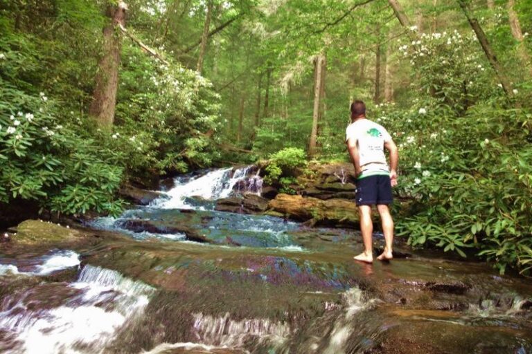
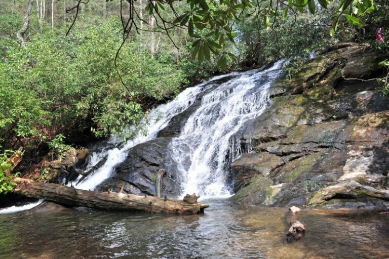
Sea Creek Falls
TYPE: Moderate
LENGTH: 0.5 miles
Sea Creek Falls is a series of 2 breathtaking waterfalls.
Located in the Cooper Creek Scenic Area, Sea Creek Falls are an easy walk of less than .5 miles. The first, or upper falls is a series of steep cascades ending in a brief drop. The second falls are also a series of steep cascades. When the water flow is heavy either in late Winter or Spring or after a summer rain these are a remarkable sight.
HELPFUL TIPS FROM LOCALS: Once you reach the first waterfall, you have to climb the steep, narrow steps to the left to get to the second larger waterfall. These steps can be dangerous and should be climbed with extreme caution. Do not let children climb unattended.
Turkey Farm Loop
TYPE: Intermediate
LENGTH: 4.7 miles round trip
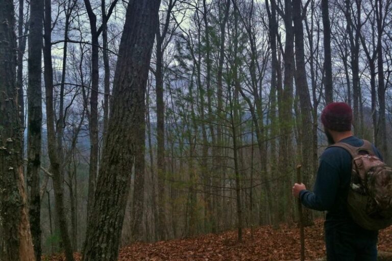
This is a 4.7 mile gravel loop around an old turkey farm. It can be hiked, driven, or biked. You will see Blue Ridge lake, old homesteads, pastures, and more. On one side of the loop, the forest road follows the shoreline of Blue Ridge Lake for some distance, and you can see some beautiful private homes along the way. The forest road on the other side the loop reveals great views of the higher peaks in the area, and reminds you of more strenuous rides for other days.
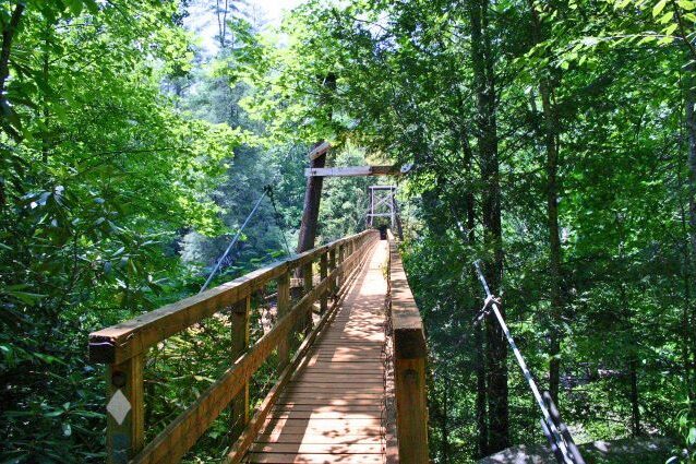
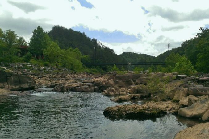
Toccoa River Swinging Bridge
TYPE: Easy
LENGTH: 1 mile round trip
Take the family on a short relaxing hike to the legendary Toccoa River Swinging Bridge. There is ample room by the river for the kids to play in the water and to enjoy a peaceful picnic by the rapids! The Swinging Bridge is a 270-foot suspension bridge located over the Toccoa River and can be reached by the Benton MacKaye Trail and the Duncan Ridge National Recreational Trail in Fannin County.
HELPFUL TIPS FROM LOCALS: There are two ways to access this trail. The most popular requires you to travel on forest service road for 4 miles and park in a designated parking area. If you begin here, the trail is 1 mile round trip. If you would prefer a longer hike, you can park at the bottom of the forest service road and begin your ascent here. If you start your hike here, the trail is 9 miles round trip.
4×4 required to access due to rough terrain
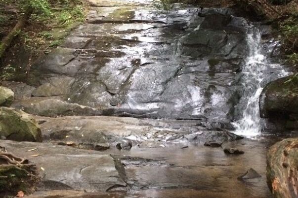
Fall Branch Falls
TYPE: Easy
LENGTH: 0.6 miles
Take a short hike to the breathtaking Fall Branch Falls! Fall Branch Falls is a 75 foot waterfall in the foothills of the Appalachian mountains. Enjoy the falls from an observation deck, located at the bottom of the falls, Or hike to the top for a birds eye view. If you want, continue on the Benton MacKaye Trail for another 2 miles (total elevation climb of 1400′ feet) for some excellent views from Rocky Mountain. (The trail actually climbs to the top of the mountain and the climb is well-done and gradual.)
HELPFUL TIPS FROM LOCALS: The trail begins on the north side of the road and starts its ascent to the top of the falls. An unmarked trail on your right leads to the base of the falls (50 yards) here an observation deck offers a spectacular view of the waterfalls. Use extreme caution around these falls! The rocks are slippery and dangerous. Return to the parking area on the same trail.
Stanley Gap Trail
TYPE: Easy
LENGTH: 0.9 miles
The Stanley Gap Trail is a 0.9 mile hiking trail that connects a parking area on Stanley Creek Road to nearby Brownlow Gap at the Rich Mountain Wilderness boundary. There is a gradual ascent of 200 feet from the creek to the gap. This trail connects into the 5.5 mile long trail that is part of the Aska Trail Area System.
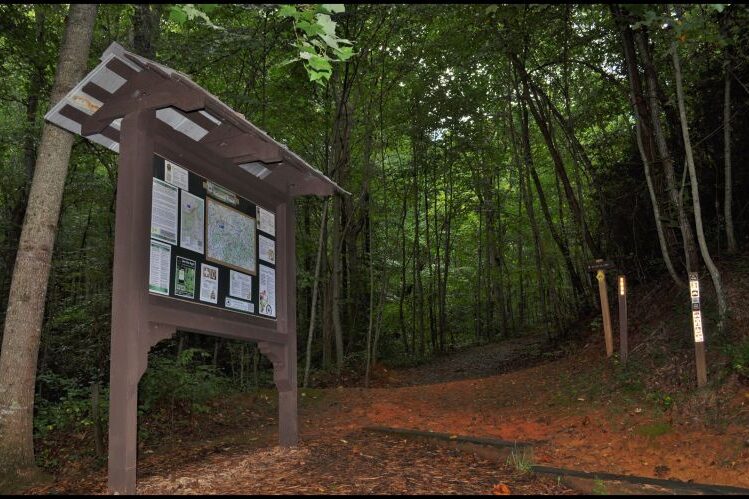
Aska Trails Area
Phone: (706)745-6928
TYPE: Easy to Difficult
LENGTH: 1 to 5.5 miles
A hiking and biking trail system 17 miles in length and open year-round. Trails range from 1 to 5.5 miles and are open all year. These trails offer long range mountain vistas as well as access points to the well known Lake Blue Ridge. The main trailhead location is at Deep Gap, a short 15-minute drive from Blue Ridge. Bulletin boards at trailheads show maps of the area, and the trail system.
Directions to Deep Gap Trailhead: From Blue Ridge, GA, go south on Aska Road 4.4 miles to Deep Gap
parking area below gap and on right side of road.
The Aska Trail System includes the following trails:
Stanley Gap Trail – 5.5 miles, moderate
Green Mountain Trail – 4.6 miles, difficult
Flat Creek Loop – 5.8 miles, moderate
Stanley Gap/Flat Creek Connector – .1 mile, easy
Long Branch Loop – 2.0 miles, moderate
HELPFUL TIPS FROM LOCALS: Trailheads require $5 parking fee. Hunting season is October through December 31. Be sure to wear bright colors and make your presence well known.
Hemp Top Trail
TYPE: Moderate
LENGTH: 6.2 miles
Enjoy mountain views, streams, and beautiful hardwood trees along this gorgeous 6.2 mile hike in the Cohutta mountains. At the end of the 6.2 miles, you will enjoy feasting your eyes on the highest peak (4200 feet) in the Cohutta mountains atop the famous Big Frog mountain.
Long Creek Falls
TYPE: Easy
LENGTH: 1.9 miles
Long Creek Falls is one of the most traveled trails in the Blue Ridge mountains. The hike in is 1.9 mile gradual ascent. You will pass by a creek and several smaller waterfalls on your way to Long Creek Falls. After approx. 1.5 miles, you will see a wooden sign leading you to Long Creek Falls. Long Creek Falls is a set of two 50 foot waterfalls located in the heart of the Blue Ridge mountains. Across from the wooden sign that says “Long Creek Falls”, you will find the entrace to Springer Mountain which is the beginning of the famous Appalachian Trail.
HELPFUL TIPS FROM LOCALS: You will park on the right side of the road. There are trails to both the left and right side of the road. You will take the LEFT trail to go to Long Creek Falls.
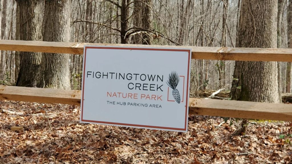
Fightingtown Creek Nature Park
TYPE: Easy
LENGTH: 12 miles
The park includes +/- 12 miles of natural surface multi-use hiking & biking trails that are always free for public use. The trails are optimized for mountain biking and hiking shared use through design and construction considerations including grade management, safety access, and sightlines. The nature park positively impacts community development, public health, nature, and passive outdoor recreation.